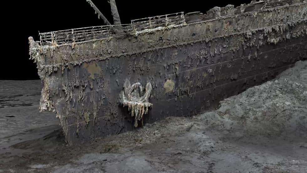
Production company Atlantic Productions is currently working on a documentary about the Titanic shipwreck and, as part of the project, they have conducted the largest 3D scan of the wreck ever made.
The scanning was carried out by Magellan, a company specializing in underwater mapping. Magellan utilized two underwater robots to capture over 700,000 images of the Titanic wreck, which lies at a depth of approximately 3,800 meters. Using these images, they were able to construct a complete 3D model of the wreck, which will be used in Atlantic’s upcoming documentary.
Researchers also hope to use the 3D model to gain a more accurate understanding of what happened when the Titanic sank in 1912.
It allows you to see the wreck as you can never see it from a submersible, and you can see the wreck in its entirety, you can see it in context and perspective. And what it’s showing you now is the true state of the wreck. We really don’t understand the character of the collision with the iceberg. We don’t even know if she hit it along the starboard side, as is shown in all the movies – she might have grounded on the iceberg, states researcher Parks Stephenson, who has been studying the Titanic for many years, to BBC News.
You can find one of the images from Magellan’s 3D scan of the Titanic above, and the video clip below contains more detailed images from the scanning process.

